Satellite Intelligence for Global Asset Portfolio
We turn satellite remote sensing into actionable intelligence - helping industries and governments assess risk, monitor infrastructure,
and protect critical assets.
We build the intelligence layer between satellites and your decisions.
Zeta Space transforms raw satellite remote sensing data into reliable risk intelligence platforms that governments, financial institutions, and industries can act on.
Multi-Spectral Processing
Parsing multi-spectral and multi-temporal remote sensing datasets to reveal critical unseen changes on Earth.
Risk Analysis Pipelines
Custom models to detect structural subsidence, land-backed portfolio threat parameters, and infrastructure flaws.
Decision Intelligence
Translating raw, complex telemetry streams into decision friendly risk scores for ESG compliance and asset protection.
Orbital Intelligence Platforms
Transforming complex remote sensing data streams into decision-ready insights for global asset portfolios, carbon markets, and custom geospatial requirements.
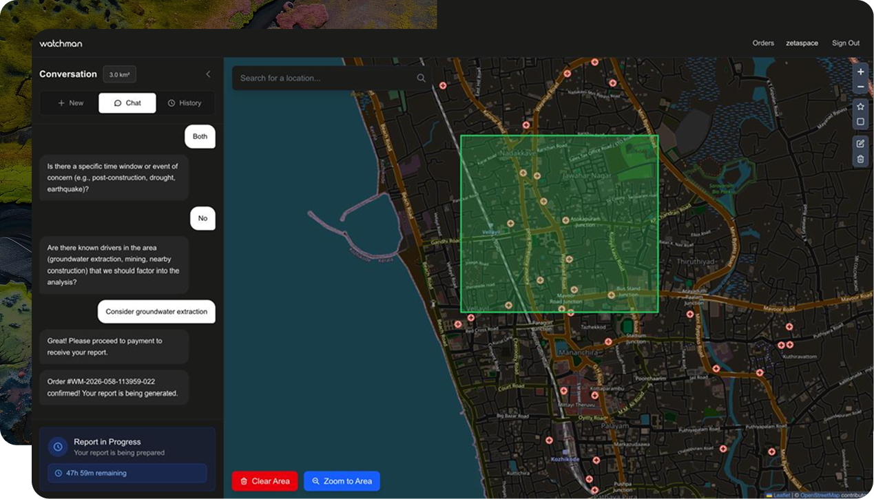
Watchman: India's First Land Risk Intelligence Platform
India's first satellite-powered land risk intelligence platform that helps investors, real-estate builders and governments to protect their land asset portfolios. Watchman delivers continuous monitoring, disaster risk scoring, and infrastructure integrity assessments, all from orbit.
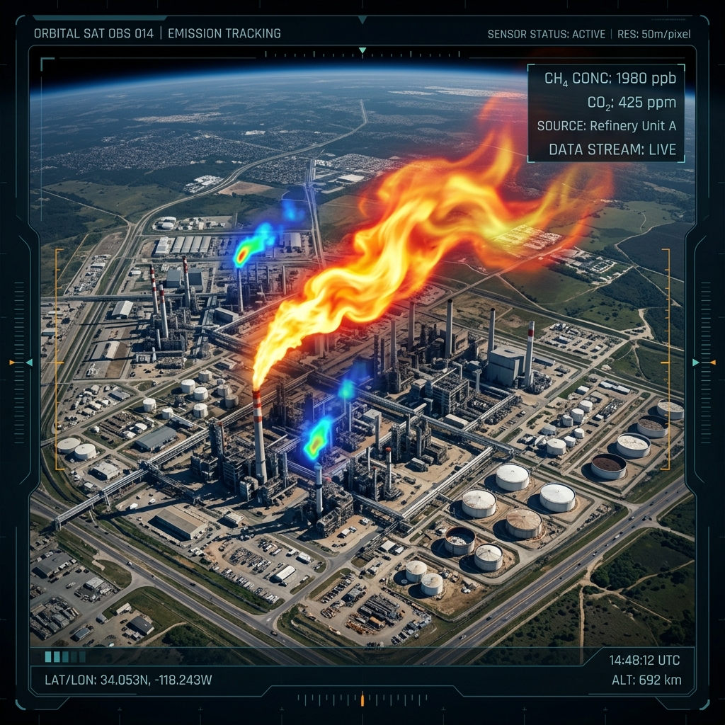
Emission Zero Suite: MRV at Scale
An end-to-end MRV intelligence platform for industrial emission monitoring, verification, and carbon market compliance. From methane plume detection to carbon credit validation, Emission Zero Suite gives industries the data confidence to operate and trade in carbon markets.
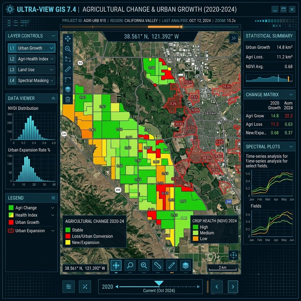
Geospatial Special Projects
We take on satellite remote sensing and GIS projects for organizations that need bespoke geospatial analysis, from multi-temporal change detection studies to custom risk mapping pipelines built for your specific geography and use case.
Latest Updates
Joining Hands with Kerala Space Park
We are now officially affiliated with Kerala Space Park (KSpace), an initiative of Government of Kerala, working to build a stronger ecosystem for space, aerospace and defence technologies. This affiliation connects us with a wider network of innovators, research institutions and industry partners committed to advancing space-led solutions for real-world challenges.
Signed MoU with University of Calicut
Zeta Space signed an MoU with the University of Calicut to support incubation and collaborative research in satellite intelligence and space technologies. The partnership will leverage academic expertise and institutional resources to advance innovation in Earth observation, remote sensing, and AI-powered geospatial intelligence.
India’s First Land Risk Intelligence Platform
Zeta Space launched Watchman; India’s first land risk intelligence platform which transforms complex satellite remote sensing data into actionable intelligence. The platform was launched by E. K. Kutty - former director of ISRO.

Have a project in mind?
Exploring a site?
Let's Power Your Mission.
Reach out to discuss your requirements, request a demo, or explore partnership opportunities.